About us
-
![]()
Workforce housing on public land
Identified locations for 170,000 affordable homes on land owned by SF Bay Area public agencies through suitability analysis on 2 million parcels across nine counties.
Client: Metropolitan Transportation Commission
-
![]()
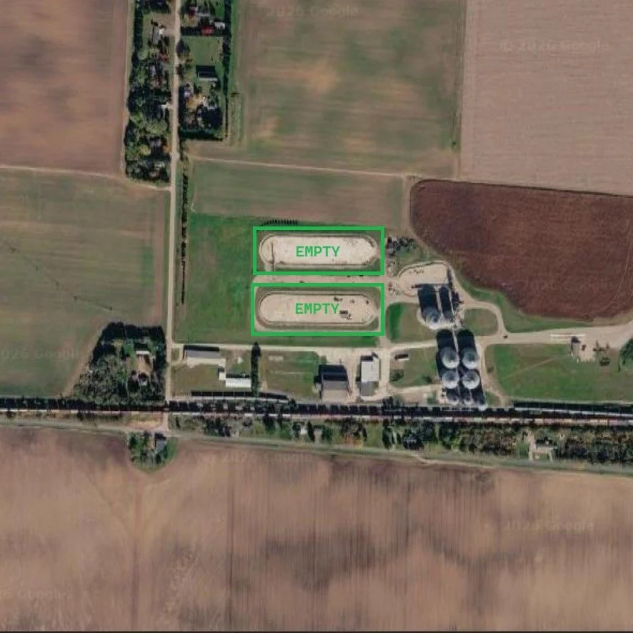
Site discovery for utility-scale solar
Completed multiple site discovery campaigns across the US that resulted in the discovery of numerous sites for utility-scale solar projects.
Client: Intersect Power (acquired by Google/Alphabet in 2025)
-
![]()
Agricultural insights from satellite imagery
Developed remote sensing pipelines to generate country-level agricultural insights. Optimized commodities trading and supported the sustainability initiatives of the largest private US company.
Client: Cargill Inc.
-
![]()
High Desert Vegetation Mapping
On a 5-acre property in Antelope Valley we are mapping vegetation using drones and geotagged photos for ground level imagery. The effort will inform future land management practices to reduce invasive species on the property.
-
![]()
Drone pilot for wetland research
In a year-long vegetation monitoring campaign, 20 UAS surveys were conducted at 4 locations in the Sacramento-San Joaquin Delta as part of NASA funded research to understand the carbon storage potential of wetlands.
Client: Dronova Lab, UC Berkeley
-
![]()
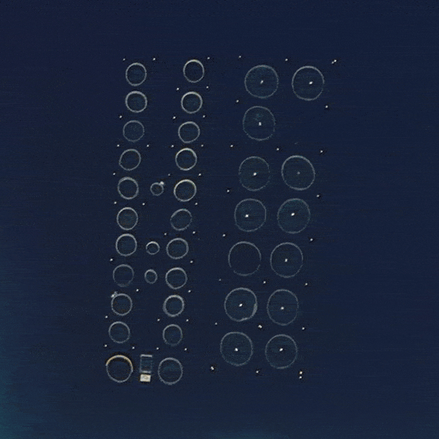
Mapping fish farms with AI
Located 6,600 fish farming cages in Greece by training and deploying deep learning model on satellite imagery. Estimated environmental impact based on bioenergetic model, water temperature, ocean current, and bathymetry.
UC Berkeley Masters Thesis
-
![Client: Aquaculture Stewardship Council]()
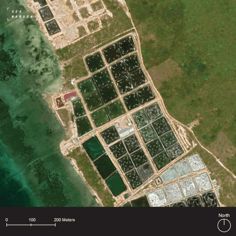
Enhancing seafood integrity with GIS data
Awarded a total of $155k in funding to develop satellite-derived Key Data Elements to enhance the integrity of seafood certification programs established by the World Wildlife Fund.
Client: Aquaculture Stewardship Council
-
![UC Berkeley]()
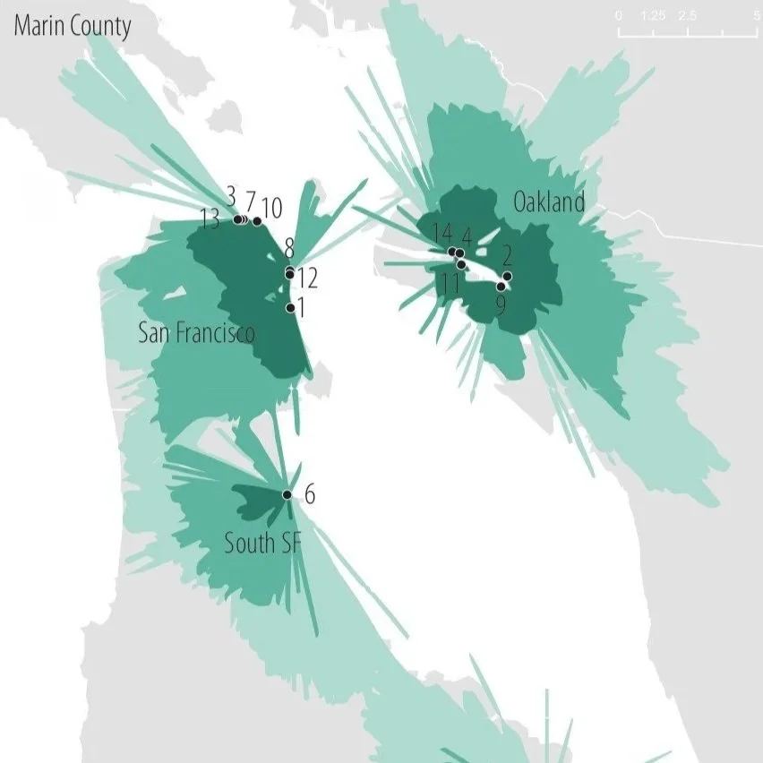
Ferry network expansion analysis
106 public docks were analyzed to identify the most suitable locations for expanding ferry service. 14 locations within 15 minutes driving distance of half a million people were selected as prime locations for future ferry service.
UC Berkeley GIS Project (C188)


Mission
Our mission is to help firms bloom by removing the complexity of spatial data. As your external geospatial team, we eliminate the burden of specialized hiring, software expenses, and operational distractions.
Service Area
We’re based in Long Beach, California and offer most geospatial services wherever you are, but field work is currently limited to Southern California.
Credentials
FAA Part 107 (UAS drone pilot)
OSHA 10
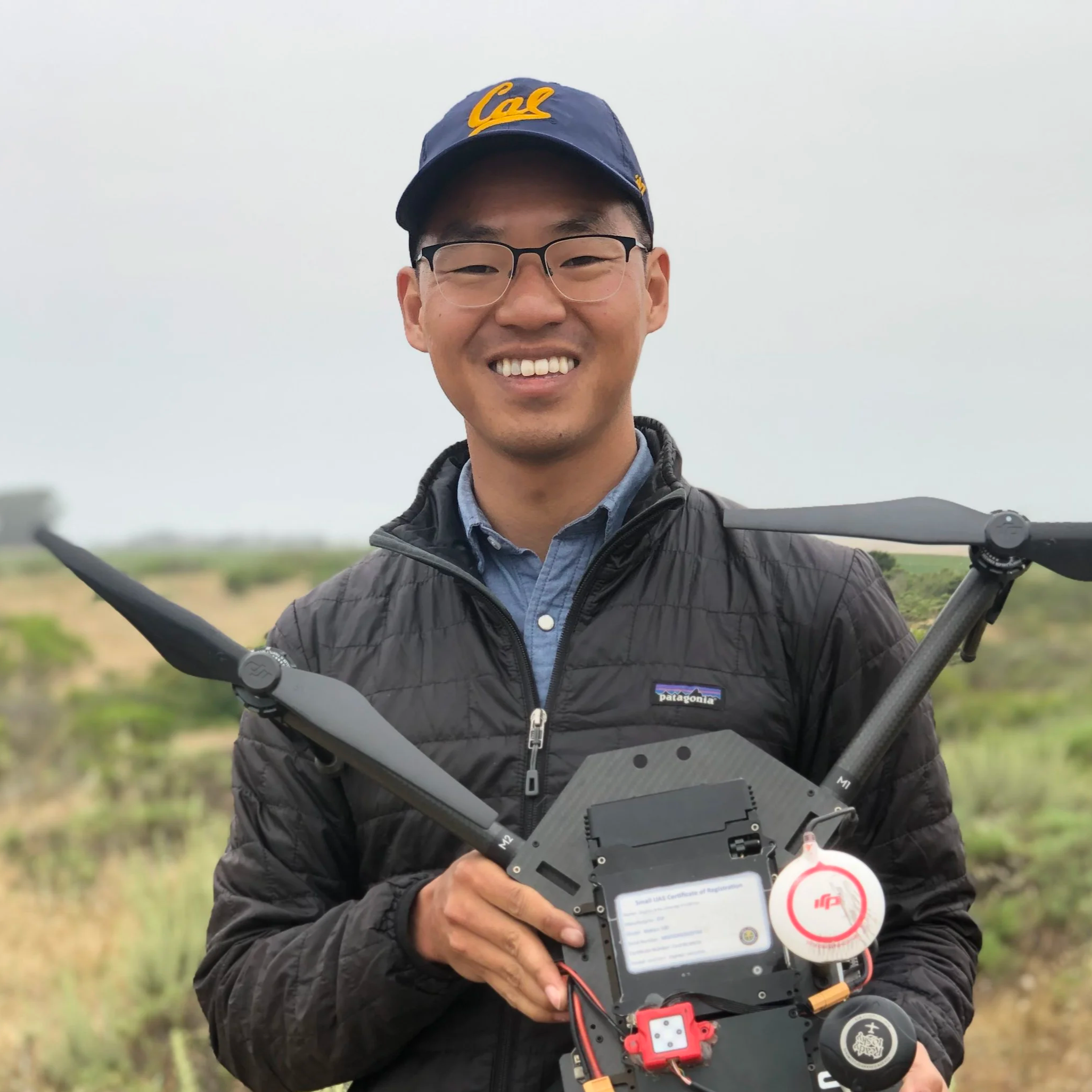
Team
Zack Dinh, GISP
After a decade supporting AEC, renewable energy, and food systems projects, Zack launched Superbloom to offer cutting edge geospatial services to organizations working to enhance our environment and communities.
Disclaimer
Superbloom Geographics provides high-precision spatial data for planning and conceptual design purposes only. We do not provide professional land surveying, boundary line determination, or construction staking services requiring a licensed Professional Land Surveyor.